Tuesday, July 6, 2010
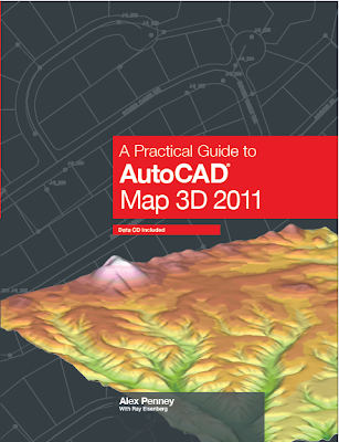
AutoCAD Map 2011: "A Practical Guide to AutoCAD Map 3D 2011"
As I mentioned in the previous post, the latest version of "A Practical Guide to AutoCAD Map 3D 2011" is now available. The retail cost is $69.95. I have a few copies at a substantial discount. Please email me at geospatialtech@gmail.com if you are interested.
Monday, June 14, 2010
AutoCAD Map 2011: "A Practical Guide to AutoCAD Map 3D 2011"
The latest version of "A Practical Guide to AutoCAD Map 3D 2011" from DigitalNode is now available.
It's the best book yet written! OK, I stole and revised that line from one of my favorite movies, Amadeus. But it's a fact. I've been training and implementing AutoCAD Map from the very beginning and I've used almost every book out there. This is truly the best designed and informative instructional book I've seen.
The author, Alex Penney, was a member of the original AutoCAD Map 3D product team and was responsible for developing training strategies and training delivery for many releases of AutoCAD Map 3D. Ray Eisenberg, who is a Senior Program Manager at Autodesk brought his instructional design and editorial expertise to the team. I was fortunate to be asked to do the technical editing on the project. It was pleasure working with Alex and Ray, they are true professionals in the industry.
Alex has a special way of taking the most complicated concept and making it understandable. That's not an easy thing to do in a training document.
Each lesson clearly details the concepts and objectives the student will learn as well as great exercises for each topic. The author explains, when needed, why you are performing a certain task during the exercise. This is the first book where I've seen that level of detail and it's extremely helpful to fully understand the task being completed.
I'm looking forward to using "A Practical Guide to AutoCAD Map 3D 2011" again in my next class.
If you would like to purchase a copy you can visit DigitalNode at www.digitalnode.com
Thursday, May 27, 2010
AutoCAD Map 3D 2010: AutoCAD Map 3D 2010 SP2
Autodesk just announced that SP2 is now available. To download this update click HERE......
This update addresses many issues. Here are a few items that have been corrected.
General
This update addresses many issues. Here are a few items that have been corrected.
General
- Cache files are left in the MapCache directory after closing AutoCAD Map 3D without saving the new drawing.
- Bulk copying from a SHP data set to Oracle would sometimes fail to copy numeric fields.
CAD on GIS
- Checking out a large number of features crashes AutoCAD Map 3D.
- Attempting to join a linestring to a multi-linestring via the PEDIT command fails.
Classification
- Some menu items in the “Define Object Classification” dialog box are drawn covered in black.
- Memory is not reclaimed after running the MAPEXPORTCURRENTMAPTODWG command.
- Object data does not get exported when running the _MAPEXPORT command from the CLI.
- EPF files are not honored when running the _MAPEXPORT command from the CLI.
- The MAPIMPORTFDO and MAPEXPORTFDO commands do not list existing ArcSDE connections.
- Mapping multiple layers to the same DGN level when exporting to DGN does not function correctly.
- The ADERSHEET command mishandles MultiLeader and MLine entities.
- FDO rasters draw at the wrong location in layout view if the layer coordinate system is different from the map coordinate system.
- FDO rasters plot at the wrong location if the layer coordinate system is different from the map coordinate system.
- Adding a bitonal raster image crashes AutoCAD Map 3D.
- Gaps sometimes display between tiled images.
- Themed DEMs are not correctly displayed when running AutoCAD Map 3D on non-English operating systems.
- After connecting to a raster image with a very long file name, clicking on the connection in the Data Connect dialog crashes AutoCAD Map 3D.
- Zooming in/out after the raster file is renamed crashes AutoCAD Map 3D.
FDO SHP
- Attributes containing Hebrew, Greek, or Cyrillic characters are not displayed correctly in the Data Table.
- Under certain conditions, a SHP file can become corrupted when updating the geometry of features.
- Connecting to a SHP data set containing an invalid SHX index file crashes AutoCAD Map 3D.
Tuesday, March 30, 2010
AutoCAD Map 3D: AutoCAD Map 3D 2011 is now available
The latest version of AutoCAD Map 3D is now available in the Subscription Center as well as a free 30 day trial.
What's new in Map 2011?
- Integrated Point Cloud tools
- Grids and Graticules tools - Create and publish maps based on U.S. government military grid reference system (MGRS) standards
- New & Enhanced Data Support
- ArcSDE 9.3.1
- Oracle® 11gR2
- Microsoft® SQL Server® 2008 SP1
- PostGIS 1.3.6
- PostgreSQL 8.3.7-1
- SQLite 3.6.14
- Performance Improvements - up to 4 x faster working with FDO data
- Windows 7 Compatible
Friday, March 26, 2010
AutoCAD 2011 based products: Google Earth Extension now available
The Google Earth Extension is now available for all AutoCAD 2011 based products in both 32 bit and 64 bit versions.
Using the Google Earth Extension‘s simple wizard-driven interface, you can publish your 3D models from AutoCAD directly into the Google Earth application. The technology preview also allows you to import a Google Earth image into AutoCAD, publish your 3D model to Google Earth, drape a Google Earth image onto a 3D mesh in AutoCAD, and attach time span information to your model.
Click here to download the Extension.
Subscribe to:
Posts (Atom)